Rain forecast to continue across Queensland prolonging flood risk
Flood warnings remain in place for large parts of Queensland after widespread rain over the weekend with the weather bureau forecasting more falls to come.
A severe thunderstorm warning is expected to be issued Monday for coastal and inland communities from Rockhampton north to Cairns.
Bureau of Meteorology forecaster Jonathan How said the area saw scattered falls between 50 to 100 millimetres on Sunday, which may continue throughout Monday.
"Depending where we see those heavier thunderstorms redeveloping we could see falls up to 50mm," he said.
Well-saturated catchments around Townsville and Cairns are a focus, with minor flood warnings in place for the Ross, Bohle and Herbert rivers.
"Any additional rainfall will flow into these rivers, so we're keeping a very close eye on what will eventuate," Mr How said.
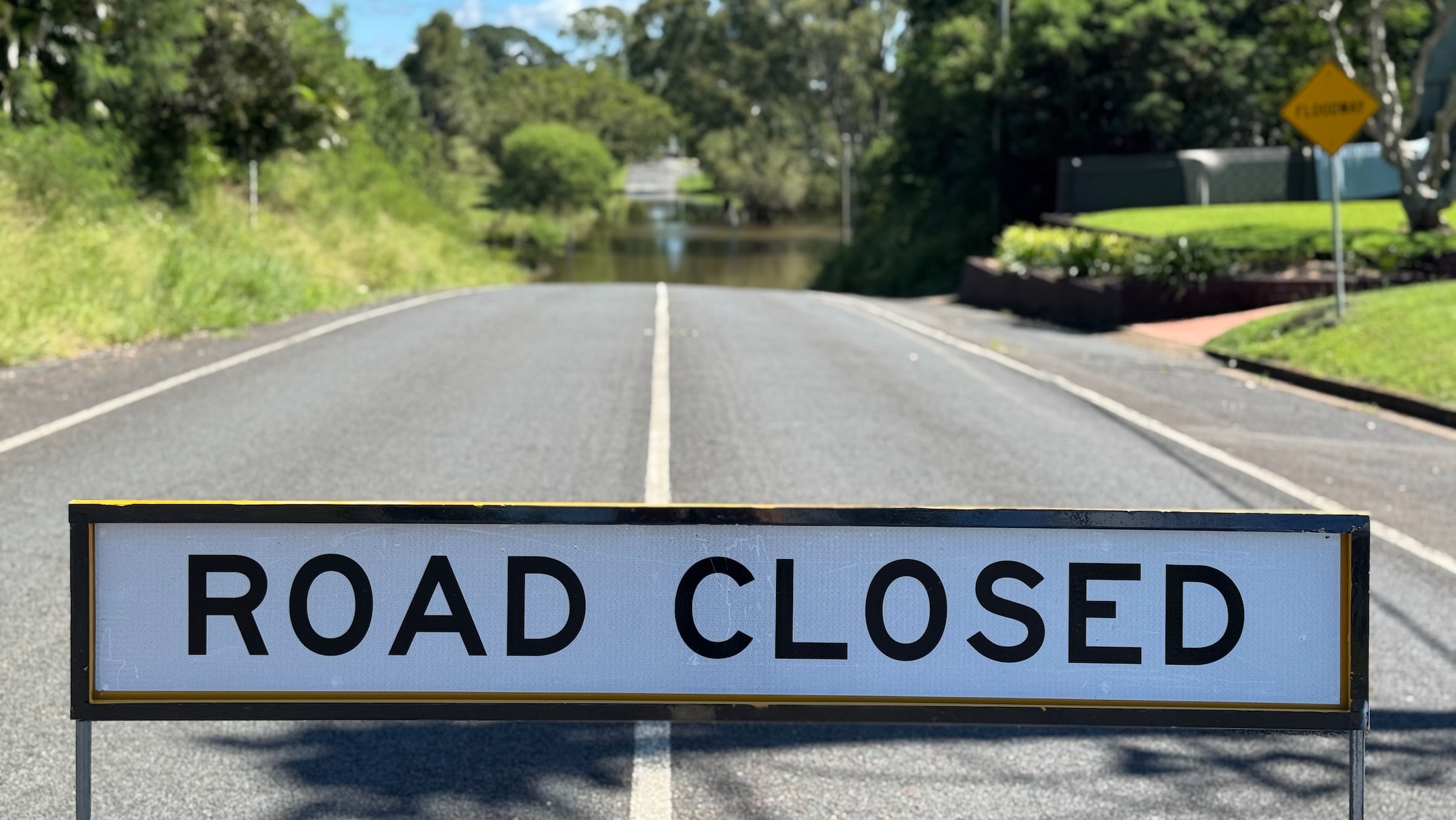
More rain on the way
In the state's west, remnants of ex-Tropical Cyclone Dianne will see rain redevelop on Tuesday before moving off towards the coast later this week.
"We'll start to see that rainfall build in the Channel Country and push into the south-east by Wednesday," Mr How said.
"We could see moderately heavy falls about the Darling Downs, Brisbane and the Gold Coast ... that will dry off by Thursday."
Major flood warnings continue for the Thomson and Barcoo rivers and Cooper Creek; the Bulloo and Paroo and Lower Warrego rivers; the Georgina River and Eyre Creek.
Flooding in the central west has already seen helicopters ferry residents to safety as water inundated the town.
Maryborough breathes sigh of relief
South-east Queensland enjoyed a sunny and warm Sunday after heavy rain on Saturday.
Maryborough pensioner Heather Copley spent Sunday walking her dog and inspecting the Mary River.
"This is a little flood … I've seen it a lot higher," she said.
"If we don't get any more rain, we might be lucky and it'll just go out to sea.
"We do not need any more rain on top of this otherwise we will be in big trouble."
Ms Copley mentioned that although flooding in Maryborough is "part of living here," it still gets the heart pounding when the water endangers houses.
She mentioned that it’s quite terrifying, making her heartbeat rapidly.
Adam Harris dedicated the morning to exploring the town with his son Manning.
Mr Harris mentioned that he had some reservations during the weekend when a significant flood alert was announced.
"You just do what you need to do when the time comes," he said.
Pub worker Jack Sheppard said everyone had been talking about the weather.
"A lot of the people I spoke to have been farming type of people and they're happy for the rain, but they're kind of over it at this point — it's more than enough."
Showers forecast
Townsville and Mackay face a possible thunderstorm and up to 20mm of rain on Monday, while Cairns can expect up to 8mm.
In the south-east region, there’s a possibility of showers for Brisbane as well as the Gold and Sunshine Coasts on Monday, preceding up to 15 to 20 millimeters of rainfall expected on Wednesday.
In the western part of the state, Mount Isa and Longreach will experience partial cloud cover along with a moderate probability of rain showers.
A low-pressure system over the Tasman Sea has the potential to generate unusually large swells as the week progresses.
"It could generate quite substantial southerly swells, which might affect several of the bay islands featuring southern-oriented shores on Tuesday and Wednesday," senior forecaster Shane Kennedy stated.